Showing posts with label k2b. Show all posts

Monday, 12 May 2014

Keswick to Barrow 2014


12 hours, 54 minutes, 38 seconds

An earlier start this year as we had to bring our team together from two different locations and try and make the 5:30 am start.  In the end we reached the start point almost on time, but had to wait to get out of the car due to everyone else trying to do the same.

We had woken at 0400 and noted that the forecast heavy rain had already started and it stayed with us till 9.


By Thirlmere

Shortly after that photo above the road was totally flooded to a depth of at least 4cm.  While some clambered on the dry stone wall or climbed up onto the grassy slope on the right, we hardy souls plodded on through the water.  I did start to wonder if two spare pairs of socks would be enough.

Four of us had started: myself, Bill, Carl and Andy.  I was the only one to have done the K2B before.  Bill had done support last year so had some idea of what to expect.  Andy was going to run it (hence the 0530 start).  Matt and Mike both wanted to do it, but Mike was ill and Matt had stepped in to do support duties.  Also on support was Andy's wife Emily with their two kids in tow.  Emily was mainly support for Andy, with Matt handling the rest of us. 

At the start Andy set off running.  I followed at a brisk pace with Bill and Carl not far behind.  It was very wet, with lots of run off from the hills:


On Dunmail Raise the rain got the better of me and I stopped on the verge to put on my over trousers and pack my electronics (including camera) into waterproof bags.  Apparently as I was doing the one-legged dance, Carl and Bill walked right past me without noticing as I caught up with them on the descent to Grasmere.  On the side roads we caught a glimpse of the sun, but had to negotiate another flooded road.  My socks were already wet so...

After Grasmere and checkpoint 1 the rain eased off, settling into occasional showers and brief glimpses of the sun.  Much better than the forecasts had threatened.

By checkpoint 3 and the second encounter with Matt I had settled into my pace - a little faster than Bill and Carl but close enough that they would catch up with me at each brief stop.
It was clear that I wasn't going to be setting any personal bests, but I would be content with less than 13 hours.  Bill was suffering from blisters early on and Carl had knee trouble but they soldiered on.

At the halfway halt I had sandwiches and changed socks.  No rain, unlike last year so the new pair went on dry.

At Lowick Bridge we heard from Matt that Andy had finished (still don't know his time!) and Em was taking him back to their camp site.  Since we walkers were bunched together, Matt was able to handle the support by himself.  However Bill was contemplating dropping out at Lowick due to his painful blisters.  I set off by myself, wanting to avoid standing still for too long.

Heading up to Rake Cross I could feel a blister forming on my right sole, so after checking in at check point 6 (30.5 miles) I visited the first aid point where they applied a nice large bandage.  I set of again and met Bill and Carl tending to their own feet. Bill was feeling he'd had enough - his feet were a mess.  I plodded on, anticipating my first sight of Barrow (an odd state of mind...).

In Marton Matt confirmed that Bill had dropped out, and was awaiting transport to the check point so that Matt could pick him up.  Carl was still going.

Once you reach Dalton you know that only something drastic can stop you.  I pushed on and turning onto Abbey Road I set my iPod to Abbey Road.  And just like last year, as Here Comes the Sun started the rain made one last appearance.  I didn't care.  I crossed the line, about 5 minutes under the 13 hours, with Matt taking my picture.  After collecting the medal and the time card I went straight into the First Aid area to get the feet checked.  This time there was a blister on my left sole.

I exited the tent and went looking for Matt, just in time to see Carl finishing - I couldn't get my camera out quick enough.  In the days leading up to the walk he'd been convinced he wouldn't get further than the 26 mile mark but in the end he finished in just over 13 hours, faster than I managed on my first outing.


So with two exhausted walkers (and poor Bill waiting in the car) we decided to forgo the free pie and the free beer(!), and left Barrow for the hotel.

That was my ninth K2B.  I'm not doing more than ten, but as 2016 is the 50th walk I might skip next year.

Sunday, 23 March 2014

You'd think I'd have learnt after the first 8 times

I'm doing the Keswick to Barrow again this year, and once again it's for the St. Giles Hospice.  This year the organizers are insisting on on-line sponsorship, so if you feel like sponsoring me, go here.

Longest walk so far this year has been 14 miles, along the old Stafford-Shrewsbury line.  Next weekend the target is 20 miles, using the Trent & Mersey Canal towpath.

Sunday, 24 March 2013

Gluttons for Punishment

Yes we're back in the K2B again this year.  By the looks of it we may already be down to just 3 walkers as some people come back to their senses

Monday, 14 May 2012

Keswick To Barrow 2012


Distance: 40 miles (allegedly)
Time: 13 hours, 15
Average Speed: 4.86 km/h (3.02 mph)

We set off from our B&B in Windermere at a little after 5am: myself, Mike Roberts and Steve Eyles, with Chris Bradshaw as our support.  Mike and I are old hands, but it was Steve's and Chris' first K2B.

It was about 35-40 minutes to reach the top of Thirlmere and then another 15 minutes to reach the dropping off point.  You can't expect to get 2400 or so people to the start line without some waiting involved and the K2B committee have made it as smooth as possible.  Chris took a quick team photo and then the three of us queued for the start.  We went through at 0607, with about 1870 people having gone through ahead of us.  This included three young women and a black labrador all dressed as bees.

The skies were clear, so it was a cold start.  There was evidence of previous rain but there wasn't to be a single drop that day, possibly a first for my attempts.  We were wearing the waterproofs anyway, just for the warmth.  A brisk walk to Thirlmere soon warmed us up.  As usual it was flat calm at that time of the morning and Helvelyn was reflected beautifully in the water.

Mike had been off work ill for much of the training period and although recovered wasn't quite fighting fit so he fell behind.  Steve and I hit much the same pace so we kept together.

After Thirlmere we hit Dunmail Raise and the sun finally found its way over the hill tops, raising the temperature.  I found myself having to take of the waterproof and shove it into the backpack, out came the hat at the same time.  I was now wearing just a t-shirt on top, not cold at all.  Steve had got ahead of me while I adjusted my kit, but I caught up with him as we reached the edge of Grasmere.  I phoned Chris at the 1 mile to the checkpoint sign to let him know we were coming.

We picked up supplies from Chris and he asked about Mike.  Steve said he was ahead of us, I said behind.  After grabbing a drink I lost sight of Steve, so unwilling to stay to long I set off again.  Steve caught up with me at the top of Red Back, which we had warning him about.  He said he was glad it was over, I said that we still had to get down the other side.  Descending punishes the parts of your feet that had been given a rest on the ascent, you also face the choice of a slow controlled descent or a mad dash.

The checkpoint at Elterwater marks the one-third stage.  I grabbed two drinks at this checkpoint, and eavesdropped on somebody having a good strop at a hapless official.  I couldn't work out what the actual complaint was, and I'm pretty sure the official was none the wiser.  Steve had already set off, so I followed him.  Other than a few glimpses over the next half-hour that was the last I saw of him until the end!  He'd obviously trained well.

I plodded on.  In a lay-by on the main road down to Coniston there was an ice cream van.  I resisted the temptation for an actual ice cream but got a cold drink from his freezer.  Not long after it was the stony track up the hill and another steep descent down to Monk Coniston.  There I met up with Chris who said he hadn't seen Steve.  Mike had been only ten minutes behind us at Grasmere, he'd started out of breath but had recovered and got his pace back.

I started the walk along the east side of Coniston and began the mental arithmetic to estimate my finish time.  I was thrown when I reached the 20 mile mark and spotted the lunch break stop without seeing the 1 mile to checkpoint warning.  Slightly clarified by the official who was having to explain to everyone that CP4 wasn't there this year, but was later on.  I was able to guess I wasn't going to beat my personal best time.  I had a quick sandwich, checked my feet, changed my socks and converted my trousers to shorts.  Then I set off before my muscles became convinced it was over.

Shortly afterwards I was passed by the bee girls and their bee dog.  They'd already passed me once or twice, but they always seemed to stop a long time at each checkpoint.  One of them remarked that I must be looking forward to a beer at the end.  Two, I said.  The first wasn't going to touch the sides.

The new home for CP4 was at Water Park at the bottom end of Coniston.  Somebody at the drinks point there had thought ahead as the was a water bowl for the dogs.  Apart from the bee dog, there must have been at least 5 other dogs including a husky.

I met Chris again at the Red Lion in Lowick, further back from the road than the usual meet up.  He'd missed Steve again, but as we were talking (and I was dumping my used socks and trouser leg ends), Mike came up.  I set off again, passing the bee girls, swiped at CP5 which had also moved this year (the community centre, not the church) and headed off for the long, slow slog up to Kirkby Moor.  Mike soon caught up, but said he'd got the the church only to be told he'd missed the checkpoint and had elected not to go back.  He was soon outpacing me.

I re-did my mental arithmetic.  With two thirds done I could just make 12 and a half hours if I picked up the pace.  But now, I could feel the blisters on my feet.  I tried to ignore them, but I knew they were going to get worse.

At the 30 mile sign I stopped to take a picture.  The bee girls were resting there and offered to take it for me while I posed by the sign.


I was through CP6 when Mike came up behind me.  He'd stopped for some crisps and I'd just gone straight through oblivious.  Soon he was outpacing me again.  Not long after my feet were in agony.  I made it to Marton and the next checkpoint.  I swiped, knocked back some water then headed straight for the First Aid point with Chris in tow.  I got tangled up trying to take the backpack of and had to sort that out before the nice St. Johns Ambulance lady could look at my feet.  A huge blister on each heel, each requiring two of the large white plasters.  After this patching up I set off as soon as I could, wanting to finish as quickly as I could.  I put on the IPod and went for a Rush live album.

The next few miles were just trudging along, trying to build up a pace and ignoring what was happening below the ankles.  You get a lot of encouragement from Marton, going through Dalton and into Barrow.  You need it.  At about 38.5 miles I passed a father and daughter struggling on.  The daughter was crying, but keeping going.

Coming up to the last mile I changed album.  Just like last year I put on Abbey Road as I was walking along Abbey Road.  Last year I started with Here Comes the Sun and had to skip a couple of tracks to finish on The End.  I didn't skip any this year, and I didn't finish on The End.  I didn't even finish on Her Majesty.  It had looped around to Something.

Chris, Mike and Steve had gone inside because they were Southern and through it was cold, so no photograph of me finishing.  There was a surprise however.  For completing seven walks you get:

For the past 48 hours I've been seeking a grant from the Ministry of Silly Walks, but I should have raised a bit over £300.

Thursday, 10 May 2012

Ready to go

Less than 36 hours to go now. All packed bar the toothbrush. I'll be trying to tweet my progress via @smwkerofin as last year, but I don't expect much of a signal.

Wednesday, 18 April 2012

The Long Mynd


Saturday 14th April
Distance: 31.8 km (19.76 mi)
Time: 7 hours 52
Average speed: 4.04 km/h (2.51 mph)

This was the second 20 mile training walk (call me a liar for 0.24 of a mile), the one with steep ascents. The first ascent was from Church Stretton (192 m above sea level) via the Cardingmill valley up to the trig point at Pole Bank (515 m by my GPS).

The weather was dry, overcast and cold. The wind encouraged me to keep my jumper on, but there was no need for my waterproof.

From Pole Bank I headed south past the gliding club and stopped at the edge of the forest to have my lunch. There was a sheep in a hollow that stared at me as I ate my two buns and a banana, never moving. I became convinced it had got stuck somehow so I went for a closer look. It moved then but still held its ground, then I saw the tiny head just beside it so I left them alone.

Changing the usual route I headed east and followed a stream to near Churchmoor Hall. I thought it was a path, and so did somebody else by the footprints, but it was just a sheep track and I had to make diversions around hawthorns. Back on the actual path I headed south-west to Plowden, a mere 200m above sea level before climbing back up to the plateau on the Long Mynd at 440m.

Heading back towards the gliding club I again saw Crouching Ewe Hidden Lamb who had left the hollow and were grazing nearby. The final stretch at height was via Cross Dyke before heading down to Little Stretton, a steep descent, and then a nice flat stroll back to the car in Church Stretton.

A good practice walk, not too fast. I had stiff legs and only proto-blisters on the feet. The next big walk is pencilled in on the 28th, a 30 mile.

Thursday, 5 April 2012

Stile Cop and the canals

Friday 30th March
Distance: 31.3 km (19.45 mi)
Time 5 hours 57
Average speed: 5.26 km/h (3.27 mph)

For this one I combined a Friday walk home with the scheduled 20 mile training walk. To make up the required distance I combined my three possible routes from Rugeley to Stafford.

Firstly I headed up Stile Cop. The weather had just turned and the glorious sunshine of the past few days had become a thick cloud covering. Worse, when in the wind it was feeling chilly. I was in a t-shirt and persisted so, it wasn't too bad out of the wind.

At Stile Cop (the only real climb, 146 m worth) I went down the track beside the bike trail then across the main road heading back into the Chase. At the stepping stones I turned right to go past the Forest Centre and follow the Cannock/Rugeley footpath back into Rugeley.

In Rugeley I followed the road to the Moseley where I picked up the canal heading for Stafford. Then it was a simple trudge back to make just shy of the 20 miles. The net result was stiff and sore legs the following day, but no blisters.

Saturday, 17 March 2012

Gnosall and back again

Distance: 26.5 km (16.47 mi)
Time: 4 hours 53
Average speed: 5.43 km/h (3.37 mph)

Not a very interesting walk this one, it followed the old Stafford-Newport Railway line and was thus a) nearly straight and b) virtually level. Unlike last year I went through Gnosall, over the canal and up to the bridge carrying the the A518 before turning around.

Sunday, 5 February 2012

Ice on the Canals

Friday 3rd February
Distance: 20.9 km (13 mi)
Time: 3 hours 54
Average speed: 5.36 km/h (3.33 mph)

The first Rugeley-to-Stafford walk of the year, alongside the Trent & Mersey and Staffs & Worcester canals. I did the same walk on almost the same day last year, for the same reasons. Then it was windy, this year cold. This time I had checked the weather forecast properly and was well wrapped up.

The forecast said it would reach 1°C, given that it was -7°C driving into work I wasn't convinced it got that high. Both canals were iced over, but only thick enough to support the ducks (and one swan). Only one thin ice warning message though, apparently the council was only worried about that part of Rugeley where the railway crosses over. The parts clear of ice were at the locks where the flow had prevented the icing. Between Tixall lock and Baswich Bridge there was a very light dusting of snow on the ice.

Compared with last year I'd taken 6 minutes more, but felt just as stiff so more training to do. Shame I ducked out of walking this morning, due to the snow.

Wednesday, 25 January 2012

Training starts again

We have a team in the Keswick to Barrow again. The difference this year is that I am now team coordinator!

Saturday, 14 May 2011

Monday, 9 May 2011

Keswick To Barrow 2011


Time: 12 hours, 16 minutes and 56 seconds.
Average speed: 3.26 mph

The weekend got off to a good start. I reached work when I realized I'd left my spare walking socks at home and only had one pair packed. Fortunately we had a couple of hours between finishing work and setting off north so I dived into Rugeley. Despite being on the edge of Cannock Chase, Rugeley has no walking/camping shops and the sport's shop had one pair of hiking socks two sizes too small. Luckily the Aldi had walking socks, plus other bits of kit so I could phone Matt who was lacking both socks and suitable trousers because the stuff he'd ordered online hadn't turned up.

Problem 2 was the M6 which was totally snarled up. On a Friday afternoon too, who'd have guessed? We made it to the registration at 5:45, collected our dog tags then headed off to Windermere and 3 different B&Bs. As usual, I found myself on the top floor.

Breakfast at 0445 was quick and cold, but for a pot of coffee laid on for us. Then a ride in the crew bus to the start to join everyone else.

0602 at the start. Andy, Matt, Mark, John, Mike.

There were six of us from PMES walking this year. Myself and Mike had both completed five walks, Andy had walked a few times before with his best being 26 miles. Matt, Mark and John were all new to the walk. On support we had Alan who had finished before.

The first two hours were wet, but we'd expected that from the forecast and were prepared. We quickly broke into three groups, Mike, Mark and John in front, then me and Matt, then Andy. Coming up Dunmail Raise the rain finally gave up and we could see glimpses of the sun. At Grasmere I packed away my now dry waterproof jacket. I had enough signal to tweet one update, but that was a rare occurance.

Red Bank slowed me down, but I caught Matt up again at the top and we descended the other side together and met Alan for the first service point. Mike was about 25 minutes ahead of us, Mark and John 10 minutes. I grabbed a couple of bars to keep me going and pushed on, but Matt took advantage of a relatively short queue for a comfort break.

On the stretch from Elterwater to Coniston the last of the quick people passed me and the other plodders. This included half a dozen squaddies wearing backpacks. I later asked one of them how heavy it was, he said 15 kg and it had taken 10 hours!

It was on the road down to Coniston that Matt caught me up again. I then reminded him that at the top of Red Back he'd asked if there were any more uphills like that and I'd said not for a while. The while was now up and we climbed the stone path, with Matt again getting ahead before I caught up with him for the downhill the other side.

At the top end of Coniston we again met Alan. He'd had to wait for Andy, then fight his way through the traffic and had only just got there a few minutes before. He'd missed Mike, Mark and John.

I pushed on, reluctant to stop for too long. Matt began to fall back from me, he thought that last downhill had done something. I got to the lunch stop alone and grabbed a sandwich while I changed my socks to dry ones (thanks Aldi!) and unzipped the legs of my trousers to convert them to shorts. As I was doing this I spotted John. He'd hurt a tendon and was contemplating whether to go on. Mark had gone ahead. Matt now arrived, feeling tired. He had been aiming for 26 miles but now wasn't so sure.

I'd been stationary for about 10 minutes and was worried about my legs seizing up and wanted to get going again. Matt wanted a few minutes longer, then he and John would follow me. I set off again, down the side of Coniston Water.

About 1230 it started to rain again, light at first. This hadn' t been forecast and I put off putting on the jacket on the assumption it wouldn't last and anyway the trees were keeping most of it off me. At the bottom end of Coniston it was obviously getting heavier and I couldn't put off getting the jacket out any longer. At the Water End drinks point I put the jacket back on.

I slogged my way past the 25 mile mark towards the Lowick checkpoint. There I met Alan who'd parked the crew bus a little way from the route. I started to tell him that Matt and John would be a way behind me, but then he said they were actually resting in the crew bus. They'd had to stop and the rescue service had dropped them off. Mark had already gone through and, he assumed, Mike had gone through before he'd got there. Andy had passed the 18 mile checkpoint and as far as they knew was still going.

I passed the tempting pub at Lowick and swiped at the checkpoint and kept going. This part is the long, slow climb up to Kirby Moor. Passing the 30 mile mark at a little over 9 hours I realized I wasn't going to beat 12 hours. Tunnel vision kicked in and I paid no attention to anything but the route. The rain eventually died away, I can't remember when but it persisted as drizzle for a while. I now know where April's usual rainfall went.

At Marton (checkpoint 7, 34.5 miles) Alan, Matt and John were waiting. I restocked on water and packed the jacket away again. A quick conflab and they were going to wait for Andy who was due around six, when I'd hope to be finishing. I said I could manage just on the drinks points left.

Passing the wildlife park I got to the point were there is actual pavement all the rest of the way so I dug out the ipod and started to wonder what music to use for the final stretch or rely on the RNG. Coming out of Dalton and near to Furness Abbey, I noticed the street was actually called Abbey Road, so that settled that. For the last mile I chose side 2 of Abbey Road, hoping the timing would work out. It didn't and I had to skip two tracks so I could walk up the drive at the finish line to The End. Mike got me finishing on the camera, which I think is the first time anyone from PMES has seen me finish as I normally manage to sneak in while nobody's looking.

As I thought, I was slower than last year. In fact it was fourth out of my six finishes. I'll have to check but it may be because I wasn't trying to keep up with the Rolls Royce guys around Thirlmere this year.

Mike found me after I'd got my results sheet printed and I asked about Mark. Mike said he'd been there 2 hours and hadn't seen him, so I pointed out he was just walking up behind him. Mike had done around 10 hours, Mark 10 hours 30 but they'd both been too tired to notice each other in the crowd.

I grabbed myself a bitter shandy (best way to make that smoothpour crap drinkable) and sat down, wondering if I'd ever stand up again. After a little while we heard from Matt that Andy had reached Marton, had tended to his blisters and was working up to continue. Five minutes later, no. Andy's legs had rebelled. He'd done 8 miles past his previous best but that was it.

Back to Windermere for a shower and some foot attention. Only two blisters, although one required two plasters to cover it. It was 9:30 when we set out for the celebratory meal and our first two choices were already shut. It had also started raining again. We settled into an Italian (The Lighthouse?) and had ordered and were enjoying our drinks and the lightning when the entire street went dark. The power was only out for five minutes, but it was worrying...

A good nights sleep, a hearty breakfast and a clear run down the motorway. We dropped Matt off in Wolverhampton in time for him to stagger off to his seat for the football, then back to PMES to pick our cars off and drive home.

Thanks to Alan for driving support, Andy for organizing, all my sponsors and to everyone at the drinks points.

Friday, 6 May 2011

One day to go

We'll be heading up to Barrow for registration this afternoon. It looks like we'll be getting wet tomorrow.

I'll try and keep people informed on my Twitter feed, but that will depend on where I can get a signal.

Monday, 2 May 2011

Friday: Three Shire Head, Axe Edge Moor and Shining Tor


Distance: 15.6 km (9.69 mi)
Time: 3 hours 28
Average speed: 4.5 km/h (2.8 mph)

I had always planned to be up a hillside somewhere on the 29th, but only decided exactly where the night before. This was the first real walk since the Saturday before, even though I'd had the entire week off. I'd collected two nasty blisters, one on each heel, and had been waiting for feet that were less sore.

When I parked at the Cat and Fiddle it was clear the weather was going to be very clear, possibly very warm but certainly very windy. I set off wearing the waterproof jacket for its windproof qualities. Apart from a couple of cyclists who were packing up at 0930, I didn't see anyone (outside a car) until I reached Three Shire Head. By that time, being down in the valley I'd shed the jacket.

The next person I met was actually working, he appeared to be repairing the path near Orchard Farm and had managed to block it with his lorry and digger. He let me pass, though I had to step over a large hole on the edge of a drop.

Near the top of Axe Edge Moor I was back in the full force of the wind, but I was keeping the jacket off because, nearing 11 am, things were getting much warmer. At the top, sheltering in the ruin were an old couple who remarked that I obviously hadn't any interest in the wedding either.

Now I started to bump into many more people, mainly cyclists. None were listening to radios.

Back at the Cat and Fiddle, still having energy and with untroubled feet I decided to push onwards and went up Shining Tor. It would have been a beautiful view, particularly with that clear blue sky, but there was a haze all around.

Sunday, 24 April 2011

30 mile training walk

Distance: 46.5 km (28.9 mi)
Time: 9 hours 51
Average speed: 4.72 km/h (2.93 mph)

I should really have done this walk today, when it's overcast, rather than yesterday when it was sunny and hot. I also wouldn't have truncated it to meet a deadline...

I set off a little before 8am with the first waypoint being Beacon Hill. Despite the sun beating down I could barely see Stafford Castle due to the smog already building. The sun was beating down and there was no wind. I was carrying a litre and a half of water and expecting to use all of it before the end.

I headed downhill, past the county showground where there were a lot of folks turning up for the Motorbike show, across Hopton Heath and down to Salt where I joined the Trent and Mersey canal. I headed east, passing Weston where I could see even more folks queueing for the county showground, and walking on towards Haywood Junction.

I left the canal to go through the Shugborough estate (lots of visitors) to get to Cannock Chase at the Punch Bowl. The Chase was the busiest I've seen this year with hordes of folks, mainly cyclists, all along the Sherbrooke valley. They seemed to have run out of parking at the visitor centre.

At the visitor centre I bought two small bottles of something fruity and cold to supplement my dwindling water supply and downed them quickly, which would turn out to be a mistake. I was planning to have my sandwiches there but in the end I could barely manage half a banana. The showers that had been forecast were plainly not going to turn up so I put on another layer of sun block and rethought my route.

Instead of heading up towards Castle Ring, I decided to just head up Kitbag Hill, then turn left and go down towards the Stony Brook Pools. Although the sun wasn't going away at least a breeze had arrived to cool me down. Walking down towards them I passed a man who asked if he was heading towards Marquis Drive. "Just up to the top there, then a little way past." Then a couple of minutes later a cyclist came up behind me and asked the way back to the car park.

"Which car park?" His face fell. "Was it the visitor centre?" "There was a building." "In which case it's back up there, then turn right." It was only after he'd disappeared from sight that I thought he might have meant Birches Valley (which hires out bikes) instead. In the unlikely event you're reading this, sorry.

With the water dwindling I headed up past Fairoak Lodge heading for the Tackeroo caravan site. However the liquids I'd already drunk to stave off the heat were backing up in the stomach. Just after I'd crossed the road and was about to reach the caravan site I had to stop and let them escape. Orange flavoured water has a better taste when coming up than many other things, if that's anything you want to take into consideration.

At the caravan site I refilled the water and resolved to be more sparing with it. Then a little retrace of the steps back to the Sherbrook valley before heading up to Anson's Bank and Brocton Field. Here I decided on another change of route, instead of heading down to Brocton Lodge and across the fields to Walton-on-the-Hill, I stayed on the route of the old railway line and down to Milford Common. Partially this was for a little variety as I hadn't been that way in ages but it was also because I knew it would be downhill all the way.

At Milford Common I treated myself to an ice cream before joining the Staffs and Worcester canal. From there it was just the standard canal side route back to Stafford and home. I also got my second wind on this stretch, at least until the final half-mile.

In the end the route was a little over a mile short of the intended, but I made that very important 6pm deadline.

I've also decided on the footware for the actual walk, the walking shoes rather than the boots. I used the shoes yesterday as it was all good paths and although I got a couple of blisters, no more than I'd expect if I was using boots and they are a lot lighter.

Two Walks

Friday 15th: Rugeley to Stafford
Distance: 19.8 km (12.3 mi)
Time: 3 hours 42
Average speed: 5.25 km/h (3.33 mph)

Another canal side walk.

Sunday 17: Macclesfield Forest and Shutlingsloe
Distance: 12.4 km (7.7 mi)
Time: 3 hours 6
Average speed: 4 km/h (2.5 mph)

A busy day in the Peak District. Sunny and warm, probably too much so.

Sunday, 10 April 2011

Saturday - the Long Mynd

Looking south from Pole Bank

Distance: 31.2 km (19.39 mi)
Time: 8 hours 3
Average speed: 3.88 km/h (2.41 mph)

This was the second 20 mile training walk (so a little short) but with some ascent/descent built in. The Long Mynd certainly delivered that as the route went from the foot to the top, about 300 m, twice.

First order of the day was to find a chemists in Church Stretton and buy some sunblock, as the forecast was for much sun. Accurately as it turned out.

The route was much the same as last year, along Carding Mill valley up to the top, north a bit then loop back around to go past Pole Bank and the Gliding Club before descending down towards Plowden and looping around eastwards before climbing back up. There I made my mistake.

I started following a wide track which I thought would lead me back up, but it didn't so I left it a just headed uphill. The route I picked turned out to be far too steep and I think I might have trespassed a little bit before I rejoined the Shropshire Way path. That cost me time as I slowed right down climbing up. I also realized I'd been drinking too much water as I could feel it sloshing around inside me. That meant an extended break while I recovered, both from the climb and the unpleasant feelings in the gut.

When I finally set off again I was rewarded with cramps in the legs. Fortunately they went away once I'd got back into my stride and I got to Cross Dyke without incident. There I ended up sharing the narrow path with steep sides with a dozen mountain bikers. Twice. I overtook them when they'd stopped for a rest, so why the lead biker had to suddenly brake and swear when he caught up with me a second time I don't know. That aside they were considerate.

The final descent down to Little Stretton is very steep, so I slowed down again. By that point I had been promising myself a pint of shandy in the pub for the last two hours. It was shut! Still that motivated me to do the last mile back to where I'd parked the car so I could get something soft to drink from the Co-op. It seems 1.5l isn't quite enough water for 20 miles, not in yesterday's weather.

Sunday, 27 March 2011

Saturday - Stone (and a little way beyond)

Distance: 33.8 km (21 mi)
Time: 6 hours 32 (including the time taken to eat the sandwiches)
Average speed: 5.17 km/h (3.21 mph)

This was the first of the 20 mile training walks, so I opted for a flat walk along the Trent & Mersey canal. To get to the canal I walked along the road to Sandon, passing some examples of the rare Staffordshire Llama.


Three llamas

After the blue skies of the last week or so, yesterday was completely clouded over, but at least there wasn't any of the threatened rain. A bit less wind would have been nice.

At Sandon I joined the Trent & Mersey heading west towards Stone. At Aston Lock just south of Stone I finally noticed that the mile post reads 46 miles to either end of the canal, making it the centre.

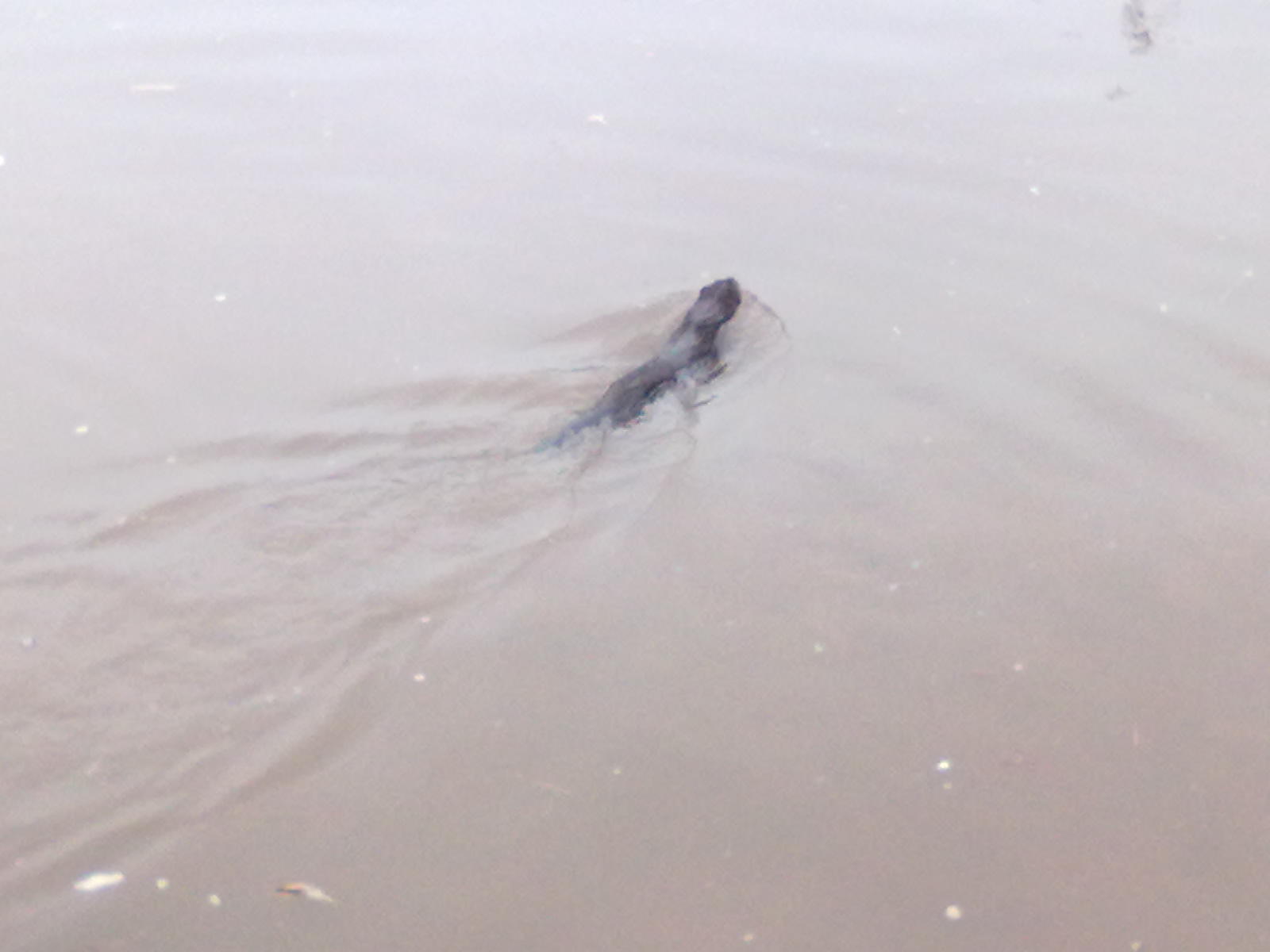
Coming up into Stone itself I and a couple of other people spotted a river creature narrowly avoiding being run over by a barge. It seemed to be trying to get up onto the western bank (the Trent side), but failing. That it was the side that the humans were walking along wasn't helping either. One of the other people there reckoned it was an immature otter. It certainly looked otter-like but I didn't think they were black.


An otter?

After that excitement it was just a steady plod along the canal through Stone and beyond to my destination: bridge 102 at the edge of Barlaston. There I had my sandwiches and a banana before turning around and heading back.

This time there was not sign of the (probable) otter, so I guess it got where it was going to.

At Aston I left the canal for a bit of variety. Unfortunately this involved walking along the path beside the A34. I did think of taking the Enson road, but I stuck on the main road until I reached Yarlet. There I did have enough willpower to avoid the pub and head off down towards Marston. That I also regretted 15 minutes later when I drank the last of my water. Still it was on the final stretch.

So that was the first 20 mile walk of the year. It left me stiff, but with no new blisters. I used a new pair of walking shoes, as opposed to my boots, so I think that I'll be using those for the K2B itself. I feel fine this morning, but I think I need to step up the training.

Friday, 25 March 2011

Friday 18th - Over the Chase

Distance: 22.2 km (13.79 mi)
Time: 4 hours 21
Average speed: 5.1 km/h (3.2 mph)

Last Friday was the start of a batch of good, spring-like weather. So good that I walked most of it in short sleeves, a hat and sunglasses.

This route was again Rugeley to Stafford but this time it was the scenic route. From work I went up to Stile Cop, then down along one of the bike trails to Miflins Valley. That particular trail isn't bike-only but is pretty steep so you have to watch out for fast bikes coming down. Fortunately the bikes were struggling going uphill.

I crossed the road and went past the pools and up to Fairoak Lodge, then across to the Tackeroo camping site and Rifle Range Corner. From there it's down to the Sherbrook Valley and up over the heathland to join the route of the old military railway. Leaving the Chase I took the footpaths across the fields from Brocton Lodge to Walton-on-the-Hill. Then I crossed the A513 and cut through the housing estate to get down to the canal to get to the other side of Baswich Bridge. Instead of continuing on to near Radford Bank, I took a footpath over the fields to the bank of the River Sow and followed that to Fairway, thence by the roads home.

It really was far too nice a day to be indoors. Unfortunately it's been that way most of this week when I've had to be in doors.

Sunday, 13 March 2011

Catching up

25th February - Canals again
Distance: 20.9 km (12.99 mi)
Time: 3 hours 49
Average speed: 5.48 km/h (3.4 mph)

This was the exact same route as earlier in the month, although the GPS reckoned it was 100 m shorter. A minute longer, which I can attribute to crossing roads in Stafford. The weather was kinder, less wind.

6th March - The Roaches
Distance: 13.8 km (8.58 mi)
Time: 3 hours 35
Average speed: 3.85 km/h (2.39 mph)

The first trip of the year to the Peak District and as usual it was to the Roaches, just north of Leek. A cold day with ice in the puddles. Only a couple of weeks earlier it had been much milder in the mornings.

12th March - Gnosall
Distance: 22.6 km (14.04 mi)
Time: 4 hours 4
Average speed: 5.56 km/h (3.45 mph)

A new route for me, for this one I followed the old railway line west out of Stafford as far as Gnosall. As it was flat and a proper path I tried an experiment and wore walking shoes rather than boots. The K2B is almost entirely roads and suits lighter footwear, but I do my training on rougher terrain wearing my boots and when it comes to doing the actual walk I prefer to use the same footwear I trained with.

The shoes were a cheap pair I'd got for everyday use, so I need to factor that I when considering the results (1 blister on the sole, could feel most of the stones on the path). No decision yet.